Manitoba Provincial Park Commemorates Engineering Feat

Duff Roblin Provincial Park in Winnipeg, Manitoba, Canada tells the story of the Red River Floodway engineering project and the premier who spearheaded it
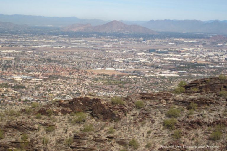
At first glance, Duff Roblin Provincial Park, located at the southern outskirts of Winnipeg, Manitoba, Canada, doesn’t look like much. A steel structure sits amid open prairie beside the Red River. However, when you read the interpretive panels and visit the viewing platform, you’ll likely be impressed by the engineering feat the park honours.
Duff Roblin Provincial Park commemorates the construction of a flood control system for the city of Winnipeg, specifically the Red River Floodway. The original floodway was built between 1962 and 1968. At the time, excavation of the floodway channel was the second largest earth moving project in the world (second only to the Panama Canal and larger than the Suez Canal project). It is often referred to as Duff’s Ditch in recognition of then-Premier Duff Roblin, who spearheaded development of the floodway.
The Red River meanders for 865 kilometres (537 miles) from the Minnesota-South Dakota boundary through the city Of Winnipeg to Lake Winnipeg, about 60 kilometres (37 miles) north of the city. Along the way 39 rivers flow into it.

The Red River has been flooding for thousands of years. Whether it floods in any given year and by how much depends on a variety of factors, such as fall and spring rain amounts, levels of snow in the winter, and the speed and timing of the spring melt. The Red River Valley is one of the flattest places in North America. When water spills over the Red River’s Banks, it spreads across the land.
I grew up in a small town south of Winnipeg. Concerns about possible flooding in spring were part of life. When I was growing up, people talked about the 1950 flood. Much of southern Manitoba, including my hometown, was under water that spring. I hadn’t been born yet, but I’d seen the photographs of my grandparents’ home surrounded by several feet of water. In a way, that flood became part of my memory too. (There had been three larger floods in recorded history, but those had occurred in the 1800s, specifically 1826, 1852, and 1861, well before living memory.)
The 1950 flood caused major damage in the city of Winnipeg. Over the course of the flood, 100,000 residents (one third of the city’s population at the time) were evacuated, 10,000 homes were destroyed, and 5,000 buildings damaged.
That flood prompted the development of the floodway. A joint federal, provincial, and municipal Royal Commission came up with recommendations to prevent the devastation of the 1950 flood happening again. The Red River Floodway was one of the recommended protection measures.

Premier Duff Roblin supported the measures, including the building of the floodway. Opponents called the floodway too expensive and said it wouldn’t work. They started calling it Roblin’s Folly. It became an election issue. The estimated cost to build the floodway was $82 million. The bill for damages from the 1950 flood came to $100 million. Manitobans supported the floodway project. The floodway came in under budget at $63 million.

The floodway is a big ditch 47 kilometres (29 miles) long. It starts at the edge of the river at Duff Roblin Provincial Park, skirts around the eastern edge of Winnipeg, and empties back into the Red River at Lockport, north of the city.

The gates that divert water from the river to the floodway are located under the river below a bridge over the Red River. That bridge is located on Courchaine Road at the park. When the floodway is put into operation, the two gates under the river are raised. When the water is high enough it flows into the floodway. Gravity pulls it north.

When the floodway gates were first built, the entire river needed to be temporarily diverted via a channel dug around the construction site. The channel on the north side was not completely filled in, leaving an inlet of water.

Interpretative panels at Duff Roblin Provincial Park detail how the floodway works and provide information about Duff Roblin. Another set of panels highlights Manitoba’s provincial park system.


Although the largest and most expensive project, the floodway was not the only recommended flood prevention measure that was implemented to protect the city and rural communities. The Shellmouth Dam holds back water on the Assinboine River. The Portage Diversion, a 29-kilometer-long (18 miles) channel 90 kilometres (56 miles) west of Winnipeg, diverts water from the Assinboine River into Lake Manitoba. A number of permanent earth dikes have been built along rivers in Winnipeg. Permanent ring dikes now surround towns along the Red River south of Winnipeg.
The first ring dike around my hometown of Morris was erected in 1966, just in time to protect the town from that spring’s flood. Unfortunately, the rented house my family lived in at the time lay just outside town limits on the other side of that dike. We moved out in the middle of the night after the river rose to levels lapping too close to the house. The house was subsequently destroyed. The town within the dike escaped damage.
The floodway, built to withstand a 1-in-100-year flood, was put to the test in 1997 during what became known as the Flood of the Century. The levels of that flood far surpassed those of 1950. The towns south of Winnipeg, including Morris, were evacuated. My parents stayed with me in my home in Winnipeg. As the flood waters moved up the river, my father watched the news in disbelief. “Where is all the water coming from?” he said. The reality of the situation sank in the morning an old friend called him to say the water had passed over a road at a higher level than in 1950.
One town south of Winnipeg, Ste. Agathe, was flooded when water crossed the rail line dike, but the ring dikes in other towns, including Morris, held. There was concern as to whether the floodway could handle what was coming and protect Winnipeg, but the floodway held. However, a new concern arose days before the crest. The La Salle River flows into the Red River north of the floodway gates. If the waters flooding the land reached the La Salle River, they would flow from the La Salle River into the Red River and flood the city. A 42-kilometre “Z-dike” was hastily erected.
Winnipeg was saved from the devastation of the 1997 flood by the floodway and that dike, but people outside the city and town ring dikes suffered great losses. Further flood-proofing took place in southern Manitoba after the 1997 flood.
Enhancements to the Red River Floodway between 2005 and 2010 expanded it to handle a 1-in-700-year flood. The expansion increased capacity from 1,700 cubic metres (60,00 cubic feet) of water per second to 4,000 cubic metres (140,000 cubic feet) per second. That is the equivalent of 1.6 Olympic pools of water rushing past in one second. The expansion project cost $628 million. The benefits may justify that expense. The cost of a major single flood in Winnipeg today is estimated at $12 billion in damages.


More numbers and statistics about the floodway can be found in the information at the park. For example, 100,000,000 cubic yards of dirt were excavated to create the channel.
The Red River Floodway was designated a National Historic Site in 2000 because of outstanding engineering achievement and its importance to Canadians.
Duff Roblin Provincial Park is also a recreation area where you can picnic, fish, watch bird migrations in fall, or snowshoe in winter. In spring you can safely view high water or watch the floodway gates go into operation.
The park is kilometer zero of the Duff Roblin Parkway Trail. Constructed during the floodway expansion, the trail allows for walking, hiking, biking, cross-country skiing, and snowshoeing along the floodway. Public access is limited at times when the trail is needed for operational use of the floodway.
Entrance to Duff Roblin Provincial Park is located on Courchaine Road. Access Courchaine Road from the east via St. Mary’s Road or from the west via Turnbull Drive. There is a public washroom on site.
(Duff Roblin Provincial Park is one of the places featured in my guide book 111 Places in Winnipeg That You Must Not Miss.)
Never miss a story. Sign up for Destinations Detours and Dreams free monthly e-newsletter and receive behind-the-scenes information and sneak peeks ahead.
PIN IT